

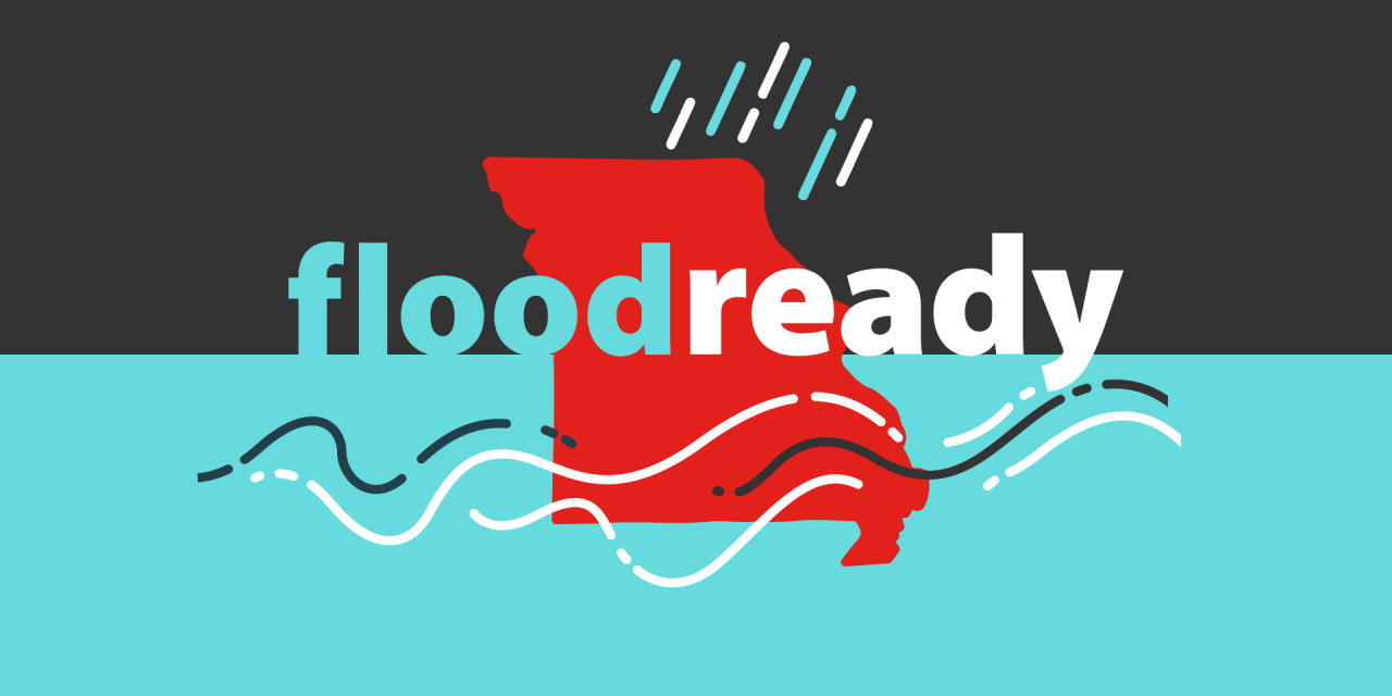
Missouri Farm Bureau, the Missouri Levee & Drainage District Association, the Coalition to Protect the Missouri River, the Missouri Department of Natural Resources, and the Missouri Department of Agriculture hosted four meetings around the state to get information to farmers about the current status of flood prevention efforts. Presenters from the Corps of Engineers, USDA, and state agencies gave great information to attendees, and we’re sharing the information with you on this week’s podcast. For more information and videos, visit mofb.org/floodready.
Presentations
Transcript
Blake Hurst, MO Farm Bureau
Alright, if everybody will have a seat we’ll begin. Thank you all for coming. My name is Blake Hurst and I live over at Tarkio. I’ve told these guys that Atchison County is the actually the perfect location for a lot more meetings than we get to hold up here. And they’ve agreed. They all love to drive up here from Jeff City. So I said, well, we’ll try to make that happen. But we thank you all for coming.
This is a time of year and a time in this flood recovery, that there’s a lot of questions that are still unanswered. I don’t know how many of them will get answered today. What I do hope is we come up with some good questions.
We have a group of both organizations and agencies that have worked together to put together these meetings. And I’m going to make a couple of thank you’s and introductions. Of course, Missouri Farm Bureau, and that’s our film crew over there. And Jo and Eric will post this on Facebook, social media. So if you would like to go back and see it again or if you have someone that wasn’t able to attend and they would like to watch it on social media, it will be up there. But the Missouri Department of Agriculture, we have Chris Klenklen, he has helped put this together. Tom Waters, who’s the chair of the Missouri Levee and Drainage District Association for the state of Missouri. Thank you, Tom. And we’re glad to see Tom. He’s the go to guy for a lot of us on the Missouri River and has been for many, many years. I mean, he started when he was really young. We have the Missouri Department of Natural Resources and Dru Buntin, I think, wants to talk a little bit about some stuff that’s going on in Jeff City.
Dru Buntin, MO DNR
Thanks, Blake, and thank you guys for being here. I’m Dru Buntin. I’m the Deputy Director of the Missouri Department of Natural Resources. I look forward to hearing the questions you all have.
Governor Parson, as many of you know early on last year, formed a group that includes many of the organizations in this room, including Farm Bureau and Levee and Drainage District Association, a number of different agencies, representatives of local government. And what he’s really interested in doing is not only having better coordination across multiple state and federal agencies in terms of how we recover from this flood event, but really looking at, how do we do some things different. You know, we tend to go back and try and put things right back like they were and we want to support that when that’s what people want to do. But if there are ways we can improve our infrastructure, to be able to withstand these kind of events better and learn from what we’ve seen in the past, the Governor is very interested in in having the state support the ability to do that and definitely encouraging us to be able to try and help move forward improvements to our system protection. And so I just look forward to the discussion today and appreciate you guys being here today.
Blake Hurst, MO Farm Bureau
All right, thank you, Dru. The final group that has been involved in putting these meetings together is the Coalition to Protect the Missouri River. They’ll be joining us later on in our tour. We’re going from here to St. Joe and then tomorrow we’re going to do I guess, Brunswick and over at Rhineland So, trying to hit all the areas that were affected by last year’s flooding.
We’re also very happy to have Joe Hegeman with Congressman Graves’ office. Joe if you’d wave. We’ve got Brandt Shields with Senator Blunt’s office. Thank you Brandt for being here. And Elizabeth Johnson with Senator Hawley’s office. Elizabeth, thank you for being here.
So I’m going to introduce the speakers in the order that they will speak. So guys pay attention. And they will, they will make a short presentation. What we’d really like to do, though, is hear what’s on your mind. And hope we’ve got some expertise up here that can answer your questions. What we will do – Farm Bureau will do – is we’re taking notes, we’ll probably get a letter put together after these four meetings, and we’ll be in contact with people that maybe can answer the questions if we don’t get them answered at the meetings. So we’ll be working the issue long after these meetings are over.
The first speaker is going to be Jud Kneuvean with the Corps of Engineers, who many most of you know I’m sure. Paul Gallagher will be next and he’ll be speaking for the RMA talking about insurance. We’ve got Corey Lesher, who will be talking about FSA programs. Brandon Viers with the NRCS, and then Dru is the Deputy Director – Dru Buntin is Deputy Director of the Missouri DNR, and he’ll be speaking on that agency’s behalf, and also, we were unable to secure anybody from either SEMA or FEMA, but Dru will hopefully be able to answer any questions that you might have about your dealings with those two organizations. So with that, we’ll turn it over to Jud, and away we go.
Jud Kneuvean, U.S. Army Corps of Engineers, Kansas City District
Good morning, everybody hear me? Alright, so I’m the Emergency Management Chief for the Kansas City District. This is kind of like Brunswick. One time I spoke and they gave me a microphone and had about a four foot cord. So I stood there and had to talk like that all night. Then they ran me out of town on a rail, so but okay, sorry about that. I’m the Emergency Management Chief of the Kansas City District. My area of responsibility really starts around the Corning, Missouri area, and I’m responsible for all the levees, primarily on the Missouri River downstream to almost St. Louis. And then when you get up into Atchison County, we talk Omaha District.
And there’s lots of differences in the systems, and you all know that. When you get up into Atchison, and you go north, they’re almost all, primarily federal levees, Congressionally authorized, designed and constructed by the Corps of Engineers, and then they’re locally owned, operated and maintained. When they’re repaired, it’s 100% federal. The local sponsor has to provide the land, easements, and right-of-way necessary to repair and then to provide the borrow.
And then once we get downstream of Atchison County, most of our systems are non-federal. So they’re smaller levee systems. They were designed and constructed locally. They’re locally owned, operated, and maintained. If they agree to abide by our operation and maintenance criteria to become active in the program, then when they’re damaged by floods, we repair those at a cost-share of 80% federal 20% non-federal, and they’re still responsible locally for the lands, easements, and right-of-way necessary to construct, and the borrow. So that’s the overview of the program.
So yeah, awesome. Yeah, that’s even worse. See if I can harmonize with myself and So it’s not lost on anyone how consequential this flood event is and continues to be for everyone in the Missouri River Basin. Repairs are progressing. Omaha District is moving to make interim repairs so they’re closing breaches. They still got a long ways to go to fix their levees. They’ve spent a couple hundred million dollars so far closing breaches. They’re estimating the need is $1.6 billion. In contrast, in the Kansas City District I need about $80 million total to repair levees. In the Kansas City District we had 119 requests for assistance. We’re going to have about 72 total projects out of that. And currently, we’ve advertised 26 projects and we’ve awarded 6 contracts. So we’re progressing slower than they do in Omaha.
But the reality of that is that if I try to do interim repairs or temporary repairs on non-fed levies, locally, you all share that cost and so it increases the cost significantly, and it takes our resources away from making the permanent repairs so we try to make permanent repairs. Instead of temporary repairs. We did make a couple of emergency measures in Holt County there at Mill Creek and Big Tarkio. We put about 544,000 tons of stone in there. And now we’re preparing for this year’s flood season. And honestly flood season’s every day of the year. There is no real season anymore.
The current forecast in the upper basin and for about 36 million acre-feet of runoff. The same time last year, we were estimating 25 million acre-feet of runoff, and we hit 60.9 million acre-feet of runoff. So we weren’t really good at forecasting that. In fact, we sucked last year trying to figure out what the end was going to look like. But every month last year, the runoff was at more than average. And then some cases it was two and three times the average runoff for a given month, except for October, and going into this year in the upper basin and we’re still seeing monthly runoff that exceeds two to three times average. The 36 million acre feet if it were to materialize would be 141% of normal and would be in the upper decile. So it’d be a top-10 run off year. The key for most of us down here though, is that it’s driven by localized heavy rainfall and we have to have a lot of water to make things really bad, but going into this spring, it’s going to be an elevated flood risk because we still have so many levees open, and we’ll just have to see how the precipitation materializes over the next several months.
For comparison, if you look at 2019 to 1993, we were 1/10 of a million acre feet from meeting the 1993 record for total run off in the base. So last year, we had about 60.9 million in the upper basin which is Sioux City upstream, and then Sioux City downstream, we exceeded 90 million acre-feet of runoff. And that’s all localized heavy rain. So last year was a very bad year and we’re hoping for a little bit better this year. So that’s what I got for you. Thank you.
Mike Dulin, U.S. Army Corps of Engineers, Kansas City District
I’m Mike Dulin. I’m from the Army Corps of Engineers, Kansas City District. I’m an emergency management specialist there. I’ve been working in emergency management for two years. And I think the flood of 2019 basically started on my one-year anniversary in the emergency management shop. So getting tossed into the frying pan’s the best way to learn, I guess.
I’m going to talk about three things today. Talk a little bit about the flood of 2019 and our response efforts. I’ll talk about levee rehab, and then I’ll talk about the spring 2020 flood outlook and what we’re doing to prepare for that.
I don’t want to spend a lot of time dwelling on the 2019 flood. I think everybody in this room knows it was a bad year for flooding, and bad is an understatement. It was unprecedented and historic flooding. Some of the worst I think we’ve seen since 1993. From a damage perspective, and from the amount of water that went through the system.
We really got hit with two events. Starting in March, we had the “bomb cyclone” come through – rain fell on snowpack, the ground was frozen, it created a tremendous amount of runoff. That all went into the system and a lot of that was unregulated flow that came down and just destroyed things through Iowa, Nebraska, the northeastern part of Kansas, Missouri, down through Kansas City and then a little east of Kansas City.
So when we got through the March event, it looked like this part of the country here was going to escape with just a couple bruises, right, but then May happened and it rained and rained and rained, and then it rained again. We had 9 of the 18 flood control reservoirs in the Kansas City District hit record levels and we saw multiple gauges along the Missouri River hit record levels too.
Between March and May combined, we had 66 levees that participate in the Corp’s PL 84-99 program overtop. Forty-five of those levee systems subsequently breached in one or more locations. Two of those systems were federal level units. One of them was R-500 and Doniphan County, Kansas. And then the other one was right here near Brunswick, 246. That’s something you don’t see every day. We don’t ever expect federal levees to fail. And so when that happens, I mean, it’s just you know, it’s unprecedented at that point.
So our EOC was activated for 279 days, making it the longest flood event and the district’s history. We didn’t see the river fully drop out of flood stage until December of 2019. So really a long event. The duration and the magnitude of this flood is something we hadn’t seen in quite a few years.
All right, that’s all I’m going to say about the flood of 2019. Other than I will a few more things. So our response effort to the 2019 flood, we were sending out field teams constantly. We issued 1.6 million sandbags, we issued over a mile of HESCO barrier, we have 25 pumps that we have at field offices throughout the district. I think all 25 of those got issued at one point or another. And then we had three automatic sandbag machines going up and down the river trying to support local flood fight efforts. And then we had three gravity-fed sandbag machines that we also dispatched. So it was a big response effort on our end. And going into 2020 we’ll be here to support you in those flood fight efforts as well.
So from all that flooding in 2019, we’re looking now at one of the largest levee rehabilitation efforts that we’ve seen since 1993. We’ve received 119 requests for assistance. A lot of those are duplicate requests, both from the March event and the May event. So when we boil it all down, we’re probably looking at about 70 overall levee rehabilitation projects. So we’ll bundle some requests for segmented levee systems. In some instances where it makes sense, we’ll bundle the contracts to try to help make things go faster. That’s why you got 119 requests for assistance, but only 70 projects, because they’ll be combining some of them.
In the levee rehab process, the first thing we’ve got to do is we got to put a document together called a project information report. And what that document is, it’s a planning document that contains a damage assessment of the levee system, contains a few repair options, and then a couple cost estimates. So we’ll submit those to our division headquarters for approval. And once they’re approved, we can request funding to pay for those projects.
Right now, we’ve submitted over 60 of those project information reports to our division headquarters, all of which have been approved, and the federal funding for those projects has all been received. So from a funding perspective, we’re looking really good.
Now on the non-federal levee systems that participate in our program, there is that 80-20 cost share like Dru was talking about. So the local levee district’s responsible for coming up with that 20% cost share. The state of Missouri stepped in to help out with that a bit. And we’re working with the levee districts – the non-federal levee sponsors – to get that money from them. And for the most part that’s going pretty smooth. So we’re getting those dollars in, once the money’s there, then we’re able to advertise those contracts. And then finally, award them after we get bids back.
So the 2020 spring flood outlook. Has everybody been checking the National Weather Service webpage frequently? I know I have. They are releasing three spring flood outlooks this year, the first one they released on February 13. The second one I think they released last Thursday, and then they’ll release another one here in the middle of March, I think around the 12th through the 15th. But in all those flood outlooks, they’re calling for above-normal chances of flooding in far eastern Kansas, and above normal chances for flooding in the entire state of Missouri. Now, what that’s going to look like exactly? Your guess is as good as mine on that.
So right now, levee rehab, over 60 projects approved. We’ve got six or eight contracts awarded already. We’ve got around 30 contracts advertised, and every week that’s going to keep going up. And I expect to see a lot of contracts getting advertised here over the next couple of weeks. And the overall goal is to have all our levee rehab contracts advertised by the summer of 2020. Now that being said, given the extent and the magnitude of the damages that we’re seeing this year, we’re still looking at a possibly a two-year levee rehabilitation effort. That doesn’t mean it’s going to take two years to fix every single one of them. Of course, a lot of are going to get repaired before that. But there’s always a couple outliers that take longer. Now, whether that’s because we’re trying to work through a real estate easement, or construction easement, maybe the levee district has an absentee landowner and they’re having a hard time getting the paperwork signed. Those are just an example of, you know, some of the issues that could come up. But we’ve got more people in the district working with our levee sponsors this year, helping them acquire the proper documentation, get their financing or get the funding in order than we ever have. So we’re doing everything we can to make this as painless as possible on the levee districts and getting construction started. So that’s all I’ll say about living rehab for right now.
But I’ll talk a little bit about the snowpack in the plains and the mountain snowpack. So in March last year, plains snowpack’s what got us, right. This year, plains snowpack in the eastern Dakotas is a little above average, or actually it’s 141% of average meaning it’s 41% above normal, and I think the snow water equivalent, a lot of those areas in eastern South Dakota, North Dakota and Minnesota is around three to five inches of snow water equivalent.
That doesn’t concern me a tremendous amount right now. I’m definitely a little worried about it because the ground is so saturated, there’s not much room for that water to absorb. However, if it melts off slowly over a matter of 10 to 12 days, give or take – it is warming up there in the Dakotas this week and a little bit last week as well – if it melts off slowly and enters the system slowly, there might not be major impacts down here, right? If it melts off in a day or two and gets rain on top of it? That’s not going to be a good situation. That’s going to enter the system fast and could cause some serious flooding.
With the mountain snowpack in Montana, that’s right around normal right now. And those big three flood control reservoirs on the mainstem Missouri River, they were able to get all their excess floodwater out of the system last year, I think in December, they got back to even. So all that room to capture mountain snowpack or mountain runoff is available. So there’s adequate flood control storage in the mainstem reservoirs. And to that point, the Kansas City District reservoirs – we have 18 of them in the district – we’ve got over 97% of our flood control storage available there too. So from a reservoir perspective, we’re looking pretty decent right now today on March 3, so if it changes tomorrow, we’ll know then.
Alright, so that’s playing snowpack, mountain snowpack. Really, I think our primary concern out here for flooding is going to be localized heavy rainfall and widespread heavy rainfall. Because especially in the Brunswick area, you got three major flood sources here – the Grand River, the Chariton and the Missouri. So you get hit by a lot of different angles. But I think going through the spring, if we get through these next few weeks here and then the plane snowpack doesn’t cost it causes a lot of headaches, it’s definitely going to be the localized heavy rainfall and widespread heavy rainfall that we’ve got to watch out for.
So if we get into another flood situation on the Missouri River, just so y’all know, the Kansas City District, we’re well prepared to support like we did last year. We’re training up our field teams, the guys and gals that we send out in the field to support the communities and levee districts. I’m holding a training session for them at 8am tomorrow morning, to get them ready to go in the event that we have to deploy folks out into the field. From a flood fight supply standpoint, we’ve got 3.6 million sandbags in the districts available at the request of local communities, the state, levee districts, all of our sandbag filling machines are available. We brought more HESCO barrier into the district this year, so we’ve got 10,000 feet of HESCO barrier available.
We’ve got 25 pumps available. Most of those are PTO pumps. So if you call the Corps of Engineers and you need a pump, we don’t have those big 12-inch drive prime diesel pumps on and ready to send out to you. That’s something we can lease, though. But it does take a bit of time to get those on-site because we have to go through a contracting process to get them. We try to get those as quickly as we can. So one of the things we’re working on – pumping was a big issue last year. We’re trying to get a pump BPA, that’s a blanket purchase agreement, in place. So that’s where we identify a vendor that has adequate supply on hand, that when we call them and say, “Hey, we need five pumps,” they have those pumps there and we could dispatch them much more rapidly. So that’s something we’re working on, an improvement we’re trying to make this year from last year. So last year, we had some delays in getting pumps on the field. And I don’t like waiting. I’m sure you don’t either.
Other things on flood preparedness, on 20 May at Napoleon, Missouri, we’re hosting a flood fight training that’ll be open to the public. We’ll invite our levee districts as well. It’s usually it’s a full day session. So in the morning, we go through like a four-hour briefing. We talk about flood fight techniques, how to organize, things like that. We talk about failure modes and levee systems and just go over the basics of flood protection structures and then temporary emergency measures that people can put in place to protect themselves from flooding. And in the afternoon, we do a hands-on session where we actually show folks how to build a sandbag levee kind of setup HESCO barrier, teach them how to operate our automatic sandbag machines and things like that. And then we’re also going to try to host another flood fight training in New Haven, Missouri, which – same kind of thing – levee districts are invited, local communities will be invited to come out to that. We haven’t set a date for that one in New Haven yet, but we’re working on that.
Paul Gallagher, USDA RMA
Good morning. My name is Paul Gallagher. I’m a senior Risk Management Specialist with the Topeka Regional Office of the Risk Management Agency. Collin Olsen, the director of the offices right over here in front. So if you have any questions, one of us will should be able to answer it.
For those of you who don’t know, Risk Management Agency is the agency that manages the federal crop insurance program. Its private insurance companies who are the ones who sell it to producers, and private insurance companies have the agents and loss adjusters to operate the program. This is a disclaimer we have disclaimers on on our information but we were asked to come in and give a presentation on the 2019 flood event and breached levees and how it’s going to impact the 2020 crop year.
As many of you know, we have a breached levee statement in Atchison County and Holt County and a lot of counties up and down the Missouri River. And so the status of the breached levees will impact crop insurance rates for the 2020 crop year for those affected by the breach.
As a recap, you guys know about this, but in March 2019, the Bomb Cyclone hit northeast Nebraska, which created extensive flooding along the Missouri River and its tributaries. That breached levees primarily north of Kansas City. Our regional office, we, we manage Missouri, Kansas, Nebraska and Colorado. So on the other side of the state of Missouri, the Mississippi River also flooded and breached several levees in Northeast Missouri. May/June 2019, high water came again, flooding came again, went through the breaches that are created in March, but it also breached several levees downstream of Kansas City as well, between Kansas City and St. Louis. It also breached several levels on the Mississippi River, up and down north and south of St. Louis. So it’s been a fairly extensive damaging event. The breached lobbies affected five states: Missouri, Kansas, Nebraska, Iowa, and Illinois. All told about 100 levee systems were breached, flooding about 500,000 acres in those five states.
And as many of you can imagine, Missouri is the hardest hit. About 80% of the damaged acres are in Missouri. Just as a point, Iowa, we have a regional office in St. Paul that manages our Iowa office. And we have a regional office in Springfield, Illinois, which manages Illinois and so in Kansas, our Topeka regional office, we manage Missouri, Kansas and Nebraska. And as you can see, it’s been fairly extensively hit.
Crop insurance indemnities for the state of Missouri for 2019, for just the flood indemnities, we’ve paid out about $93 million, just for flood indemnities which is by far and away the highest in the nation. If we add in another category of indemnities, called excessive moisture, between flood and excessive moisture, about $425 million was paid out for the 2019 flood event. As many of you know, crop insurance rates crop insurance rates reflect the risk associated with growing crops that particular area
Along the Missouri River, we have high risk areas. And those high risk areas are to account for that added risk of flooding along the Missouri River. The additive premium rates are associated with matching the rates associated with growing crops in that area. So rates reflect risk and that’s true for all crops in our region, all crops in all counties. Now, a lot of the rates along the Missouri River, we’ve developed high risk areas and those that’s where we tie the additive rates associated with that. In county several counties like Holt County, Atchison County, there are multiple high risk areas. And each high risk area has a different rate based on the past flooding associated with that land. It’s also tied to the levees in that area as in terms of overtopping. So the levy has an overtopping height that maybe over top three or four times over the last 30 or 40 years that will have one rate, which will be different than the rate on the unprotected side of the levee, which may flood several times since then.
So usually the highest rate in the county is going to be that rate between the river and the levee. And there’ll be other subcategories or sub-high risk areas on the protected side of the levee. But when the levees breached that changed everything. When the levees breached, the classification system we had on the actuarial documents is no longer reflective, because the breach changed the risk associated with the land behind that levee. That land now has the same risk associated with the risk on the unprotected side of the levee. You can follow that. And so that’s why our actuarial documents today reflect the levee system or the high risk area that typically happens here year-round, meaning the levees are fixed, the levees are offering protection. When the levees breached it changed how we manage risk. We understand that levees are being fixed on a day-to-day basis. So when a levee gets fixed, the risk goes back to the way it was. When levies are still open, the risk is still there, still exposed. And so we put in a breached levee statement to account for that risk. The breached levee statement, on all the actuarial documents back in November, basically states that if the levee is repaired by a certain date, closing date, earliest point date in their area, earliest plant date for corn is April. If it’s if it’s repaired by then, then the rates will go back to the way is on the actuarial documents, meaning you’ll get the rate you had in the past; 2019, 2018 and so forth. But if that breach is not fixed, what’s going to happen is that you’ll get the highest rate in the county. The highest rate in the county is on the unprotected side of the levee. You’ll get exposed to that rate, if it’s not fixed by that date.
We’ve been using this statement off and on – well, we’ve been using this statement every time there’s a breached levee, basically for the better part of 15 or 20 years. What’s new this year is that language in the red. The top part of the language is the standard language. We added the language on the bottom, which has two key elements to it. One of them is a partial repair. If the levy is partially repaired, meaning not to full height, the height it had been in past but maybe a little bit lesser, then we will account for that and our actuarial rate that gets charged. You won’t get charged the highest rate in the county, but then again, you won’t get charged what you got charged last year. It’ll be something higher, somewhere in between.
We’re also requiring certification of these levees. Meaning that if the levee’s has been repaired, either to the lesser height or to the full height, we need certification from an engineer that tells us, “That levee’s back and ready to go.” Now for the levees that are associated with the Corps of Engineers that Jud manages and Omaha manages and so forth, we have good rapport with these agencies, with the Corps districts. We have four Corps districts in our area: Omaha, Kansas City, St. Louis, and Rock Island. And so we have good rapport going back and forth and finding out when levees have been fixed, and we’ll record that in our documents.
But it’s the private lobbies that, if the private levee’s repaired, we are going to need that private levee owner to have a certification from a professional engineer that tells us that levee has been prepared to its prior height, or is good to go, that we can account for it. So that’s a key change in that breached levee statement. These are the counties to which we applied the breached levee statement in our area. We don’t have Iowa listed there, we don’t have Illinois listed there, because they’re not in our region. But this is just our region right here. About 33 counties have a breached levee statement.
Applying the statement for any repair to the breached levee system, the Topeka regional office must receive certification from the US Army Corps of Engineers, and that’s for the Corps’ levees, or from a private engineer, if it’s for private lobbies. Again, we’ve got good rapport with the Corps of Engineers and so we go back and forth with them. We communicate with them via email or phone or however it works out.
For private levee systems, the insurance company or the agent will need to provide us a written statement that says, “This levee has been fixed.” As the sales closing date approaches we will notify insurance companies of the breached levee status, via informational memos. We’ve posted two informational memorandums already, on February 14 and February 26, which identified the breached levees in the state of Missouri. We’ve posted on our website and we’ll let insurance companies know it. And then there’s another element of the breached levee statement about damaged soils. Insurance companies will need to make a determination if damage soils have been restored, which is done proceeding any claim.
We have additional information on that on our frequently asked questions document. I put some on the back table back there. And it’s also posted on our website, what we mean by damaged soils and what’s it going to take to repair. Applying the statement regarding temporary repairs, for temporary interim repairs when RMA received notification from either the Corps of Engineers from Corps levees, or for private levees a signed, sealed certification from a professional engineer that the levee has been repaired as a temporary basis, and at what level the temporary basis was. Once we receive that information on a private levee, for instance, or a Corps levee, we will be able to calculate a rate and apply that rate to all the land behind that levee. Written agreements will not be necessary. We will do it automatically. The information we’ll need from a private engineer on these private levees will basically help us calculate that rate. One, it’ll be a signed, sealed certification from the engineer saying this lobby works, it’s been repaired, it’ll tell us the information we need to be able to calculate that rate. Again, it’s the insurance companies or the agents who can provide that information to us. We need one certification per per levee, not one certification per producer, just one certification per levee. We will be able to apply that rate.
As an example of breach levies in 2019. Many of you know in Atchison County that L-550 was breached in March 2019. There are seven breaches on it. The Corps of Engineers stated the breaches have been closed. We’ve been working with the Omaha district and communicating with the Omaha district as to what exactly that closure means, what level of protection has been restored. We are working with them, we expect to talk to them again. We talked to him late last week. We’ll talk to them again early to mid this week to get a little more information from them. We have the 1130 breached levee statement for spring-planted crops put on there. The rate behind the levee will reflect the breach with the lowest level of protection, provided the applicable statement criteria have been met.
So if there’s seven breaches on it, and they got one breach, that all maybe six of them to repair to full height, but one of them hasn’t been, that one that hasn’t been will determine what the rate is behind that levee. And then once we make that determination, we’ll apply that calculated rate to all the acreage behind that levee, which is about 30,000 acres or so.
As I alluded to earlier, we issue informational memorandums. I put the latest one we issued last week on the back table for Missouri. These informational memorandums – we issued one on the 14th and 26th and we’ll continue to update them through the earliest plant date. The earliest point date for corn here is in early April. They identify the breached levees, the status of the repairs. Attached to the memos are maps identifying the affected acreage. Basically this is the interior part of the memo. This identifies the breached levees.
We have three categories which we identify: levees that have not been repaired; levees that have been repaired to prior status, meaning they’re good to go; and then levees that are temporarily repaired. And the levees that are temporarily repaired, those are the ones we’ll need to calculate a new rate with. We’ll also issue maps – and this is the map of Atchison County – we identify the breached levee areas, basically these maps will will take the place of current maps in the in the actual information browser. So the rate there in the middle between L-550. It’s got a big B in the middle. That means that’s going to be the highest rate in the county until that levee has been certified to have been fixed. These are the levees that we’ve certified repaired to prior specifications. Most of them are in the northeast of Missouri. Then we got a couple in Carroll and Boone County. Here the levees that we have so far that have partial or permanent repairs but not to prior specifications. They’ve been repaired to a lesser height with the exception of the Elm Point levee that’s been temporarily repaired but up to a full height, and that full height does offer the same level of protection as before. So we’ll be need to be calculating rates for those top five levee systems and then will apply them to all the acreage behind that levee system if they’re not fully repaired by the earliest plant date. Insurance can still submit written agreements to us on these partial repairs. We’ll get that information so we won’t need any written agreement from insurance. But insurance can still submit written agreements to us if the three scenarios that have occurred, if we’ve identified your crop land as being flooded by the breached levee but the reality is that it hasn’t been, you can submit a written agreement and we’ll evaluate your request.
The second thing, if an insured disagrees with the high risk rate we assigned based on the temporary interim repaired level, you can submit a written agreement for that and we’ll evaluate it. And then finally, if the levee has been repaired after the stated deadlines, meeting after the sales closing date or after the earliest plant date but before you plant the crop, then we will consider a written agreement for that. Once you plant the crop, insurance attaches to that acreage, insurance attaches to that crop. And that’s when everything gets kind of locked in stone.
Here’s a closing slide. It’s our ending slide. We’ve got a frequently asked questions document on our website www.rma.usda.gov. We do issue informational memorandums. We anticipate issuing another one at the end of this week or early next week, but they should be on a weekly basis pretty much from here on out and those informational memorandums will have the information of, these are the levels that we’ve got recorded as fixed. these are these are the lobbies have not been fixed. And again, there’s a copy back there from Missouri, if there’s still one available. Then you can certainly call our office anytime, we’ll certainly answer questions as you need them. I think there’s a couple more presentations. So that’s it.
Corey Lesher, USDA FSA
Thank you. My name is Corey Lesher. I’m with the Farm Service Agency here in Atchison County. And I’m going to talk about the available programs we have for the flood recovery of 2019.
First of all, the most immediate deadline we have coming up is on March 15, which is our regular farm program that you sign up for every year. With the new farm bill that was passed in 2018, there’s some decisions that need to be made this time around. And on the subject of flood and all the Prevent Plant we had in 2019, we’re really encouraging everybody to look at what we call the ARC-Individual program. That basically sets a guarantee for your operation. And with zero revenue, you’re guaranteeing yourself a payment for at least one year. With this sign up this time around you are making a decision for the 2019 and 2020 crop years at the same time. So with the outlook of ‘20 possibly being somewhat wet again. ARC-Individual is probably the route you might want to heavily look at for at least 2019.
The second thing that we have, and I’ve dealt with a lot of you guys on this these past few months, it’s called the Emergency Conservation Program. And that’s basically what we have available cost-share wise to help get the land back in shape due to the flood. So removing sand, cleaning out drainage ditches, cleaning up debris, fixing scours, that kind of thing. Our office will pay up to 75% cost-share to assist with that. And the primary thing that you need to keep in mind is that our office needs to do a field visit before you start any work. And I know I’ve been on a lot of your guys’ farms over the past few months, so just keep that in mind. I’ve had a couple questions. We started doing those field visits late summer, and once we do an approval on those, we have a deadline to complete the work of six months. So those first ones that we looked at last summer, we’re coming up on that six month deadline, and we’re tracking that in the office but we may be contacting you or if you know you’re getting close to those deadlines, just come in and ask for an extension. We’re going to be pretty lenient on giving another six months to get that work completed. Just because of getting the levees repaired and the soil being saturated for so long out there.
The third thing I wanted to talk about, and you guys know from coming in the office we use acronyms like crazy, but the third thing that we have going on we call WHIP Plus. That’s the acronym for the program. It covers crop loss due to flood. It does not help with Prevent Plant, but we’re talking about failed acres, reduced yield. The Secretary of Agriculture just last week included another “cause of loss” of excessive moisture. So maybe your land didn’t flood but was saturated just because of seep water and that kind of thing. That sign up for excessive moisture starts March 23. And this program looks at your crop insurance units and indemnities that were paid through crop insurance, and possibly will pick up an additional few dollars on each of those units that had losses. Another big program we’ve had this the last few months was the On Farm Storage Program. That’s for losses due to that. As everyone knows, we lost a lot of grain out here on the bottom. If that was in grain bins, at FSA we will help compensate for that. We’re paying $2.70 a bushel on corn and $6.375 on soybeans. So I think everybody has probably been in the office on that. But if you haven’t, you might want to go ahead and come in. We’re asking you to certify the number of bushels that were lost and where those bins were located. And we will process the payment the very next day. So it’s pretty quick turnaround.
Finally, with the upcoming year, we don’t know exactly what’s going to happen out here on the bottom for 2020. We were starting to get a lot of questions about Prevent Plant already, like what do we need to be concerned about or doing with that. Again, we’re going to be extremely lenient at the FSA office. Just because of the levees, although the maybe ours are patched but maybe aren’t quite up to specs just yet. There’s going to be a lot of uncertainty out here on whether or not you’re going to want to plant or attempt to plant. So what I can say from the FSA standpoint is, it’s extremely important to just make sure you have an accurate crop report with us. That’s the one requirement for every program that we have.
On the subject of Prevent Plant, we can’t accept a Prevent Plant claim or request until after the final plant date for the crop has passed. So for corn, that’s May 25. Soybeans is June 20. So just like last year, we may have to wait until those dates come and go, and then we can start accepting the Prevent Plant claims. But we will be approving all those locally. Unless it stays like this and we don’t get a single drop of water over the next few months and you’re able to plant – which, we hope you are able to plant – again, we’re going to be pretty lenient on approving those for program purposes. I think that is the five minute version of what we’ve got going on at the FSA office right now. So I’ll be here for questions and I’ll turn it over to the next speaker.
Brandon Viers, USDA NRCS
Well, good morning. My name is Brandon Viers. I’m a civil engineer with the Natural Resources Conservation Service, located in Columbia, Missouri. I want to talk a little bit about our primary tool that we have for recovery assistance. And that is the Emergency Watershed Protection Program. Before I get started into my presentation here, I do want to recognize Chris Raider. She is the District Conservationist here. Thanks, Chris. So she’s your local point of contact. I also need to recognize the Program Manager for the Emergency Watershed Protection Program, and that is Marty Comstock. He’s the State Engineer. He’s my boss. He couldn’t be here, as he had prior engagements. So he sent me in his place, so I’ll try to do the best I can.
If you look at the picture up there on the left side, I wanted to highlight this since we’re up in this part of the Missouri we did a exigency project, which means there’s an imminent threat to life and property. We typically don’t have agencies do that – usually we’re just doing a regular EWP, if you will, recovery assistance, but this particular one did pose an imminent threat. This is up on the Little Tarkio River near the town of Fortescue. I hope you’re familiar with that location. The levee breach there on the left hand side of the photo is from Missouri River floodwaters. And the breaching of that levee then was directing water directly at that second levee there on the right hand side. It eroded that levee away. We were able to come in with the sponsor’s requested assistance, we came in and added a bunch of rock rip rap and built up that levee and protected that levee, which in turn saved the town of Fortescue and several farmsteads and valuable crop ground as well. So just want to highlight that’s one of the things that we actually did accomplish.
Again, my I’m talking about the EWP program, or Emergency Watershed Protection program. I’ll refer to that as the EWP Program. Sorry for all the acronyms. Like Corey said, we have a lot of them in the federal government. But the EWP recovery assistance program is our primary recovery assistance program. It can be activated in natural disasters of several types, including earthquakes, wind storms, drought, fire, tornadoes. And of course, the reason we’re all here – floods. That particular program has to be conducted through a sponsor. We cannot work directly with the landowner on the EWP Program. So you have to get a sponsor to help you out if you have a need for repairs.
On the other hand of that, with the Floodplain Easement Program, we do work directly with the land owner on those programs, I’ll go into a little more detail about the Floodplain Easement Program later. Primarily I want to focus on the recovery assistance, or the EWP program, at this time. Of course, the recovery measures must reduce stress to life or property. And it must be economically, environmentally, and socially defensible. I’ll go into more detail about that later.
And as I’ve already said, recovery assistance must be through eligible project sponsors. Your typical repairs with flood recovery are, of course, levee repair. They have to be non-federal, non-US Army Corps of Engineers eligible levees, or non-FEMA levees. We can also do sediment removal from drainage ditches, from primary ditches. They have to drain more than one property – they can’t just drain your property. We can do streambank stabilization, as I pointed out there at Fortescue, to protect roads, bridges and buildings. Usually we can’t just do stream stabilization on a location on the river – there usually has to be some other infrastructure in place that we’re trying to help protect, the reason being we have to have an economically viable project. The benefits must outweigh the cost of the repairs. So that’s why we usually have to have a bridge or a road or something near the stream to help protect. And then also we can do log jam removal from channels; either natural or or constructed channels.
Eligible sponsors include state governments, cities, towns, municipal authorities, primarily the ones that we’re working with are going to be the drainage or levee districts and the county commissioners. Sponsor responsibilities include making applications for EWP assistance. Typically that happens within 60 days of a disaster being declared. Last year’s flood lasted forever, as you all are certainly aware. I think finally they determined that the flood was completed in the middle of December, I think, so we have waved that 60-day time period because the flooding lasted so long, and we just couldn’t get out to see the sites. The sponsor has to obtain the land rights and security permits that are needed, provide design services – we have optional there in parentheses. On smaller, less-involved projects, NRCS will help provide design services, but on the larger dollar value ones we task it to the sponsors to provide that design service. We are still accepting requests for assistance. Because like I said, we’ve just now got done with flooding. So we’re still taking applications.
Administer local contracts for repairs – the sponsor is going to have to secure a contractor through a bidding process, or they can use their own forces. And then – as with all government programs, it seems – we have a cost-share portion. The sponsor must contribute at least 25% toward the project and NRCS covers 75%, then completes the post-project operation and maintenance. Eligible measures again must reduce threat to life or property, provide protection from additional flooding, erosion, remove debris that affects runoff and restore hydraulic capacity to channels, cleaning up channels, disposal of animal carcasses when they meet the definition of debris. I think maybe Nebraska does some of this. I don’t know that we’ve ever done any of that in Missouri. Repair of damage to watershed structures, flood control structures that NRCS has put in over the years. And again, they must be economically, socially, and environmentally defensible, and technically sound.
Again, I highlighted on that the benefits must outweigh the costs. That’s the economic part of that environmentally defensible. We have to check to make sure there aren’t any, for example, threatened or endangered species, we’re not going to put in a recovery measure that’s going to impact those species. And technically sound. We can’t just throw in the essence of every repair, let’s say we can’t just put the levy right back on the bank. We need to have a setback so that we have some buffer there so that we won’t lose a levee, again, hopefully.
Not eligible measures: we can’t provide assistance on federal lands, federal highways, we cannot repair the same structure more than two times in 10 years. Performing normal O&M activities, we’re doing a lot of sediment removal. If that sediment was deposited, there just over the years from erosion or whatever, we can’t we can’t cost-share on that. If it was deposited there by the flood though we certainly can. So correcting pre-disaster damage, I just hit on that point.
Repairing transportation facilities: we can’t repair roads, bridges, etc. We can protect but we can’t repair. And then repairing levees on channels with more than 400 square miles of drainage area, or systems in the US Army Corps of Engineers program. We did get a waiver on this – we can assist for on levees that are greater than that 400 square mile drainage for the 2019 flood. And of course, we can’t increase capacity or protection level. We can’t dig the ditch out deeper and wider. We can’t raise the levee higher than it was before. At performance time, the exigency situations like the one at Fortescue where loss of life and property is imminent. And we do go through next video expedited application approval process. We have 10 days to complete the work from funding. Non-exigent was the majority of what I worked, and that’s when the threat to life or property is not imminent. We have 220 days to complete the work, from once the funding is secured a little bit of a kind of a step by step here the EDP assistance process.
Of course, we have to have the disaster declaration before the Emergency Watershed Protection Program is activated. We will coordinate with FEMA and other partners to see who’s going to be the responsible party for assisting. And then, if they determine it’s NRCS, the sponsor makes a request. As Chris highlighted, we are still accepting late requests. To date from the 2019 flood, we received 132 requests for assistance. And then NRCS will go out and do a damage survey report. That is a report to assess the damage, obviously, and what we think it’s going to take to repair that damage, how much property and everything that’s impacted by this damage. To date we have approved and funded 128 DSRs. And then of course, funding is allocated for the DSR through Washington DC. And we’re almost at 35 million in improved funding at this point. We’re expecting about another 30 DSRs, because as I’ve said before, we haven’t quite got through all the flooding yet, so we can’t access the sites. We’re expecting approximately 3 million extra dollars of requests for that.
And then, of course, we have the cooperative agreement with a sponsor which we are actively, diligently working on those as we speak. The sponsor has to get plans, permits, and land rights approved. Of course, then you hire a contractor, the work is completed, and then the sponsor’s reimbursed for those costs. So that’s kind of where we’re at. We do have a few agreements in place now. We have had some work being completed, or at least started, in some of our earlier counties that we were able to access. So now, I say that was the recovery program that we have to do through a sponsor. Now I’m going to talk about the floodplain easements that we can do with the individual landowner. Of course, floodplain easement is a voluntary perpetual easement it’s an easement forever. It’s purchased by the federal government and held by USDA. The landowner gets a one time payment, and the land owner still retains the title and rights to the ground. Just because it has a public easement doesn’t mean the public can have access to it. But you’re basically limited to the recreational use of the land, you can’t develop it, obviously can’t grow crops on it for profit. Basically just there for rec ground. Eligible land or floodplain lands damaged by flooding once in the previous calendar year, or floodplain lands damaged by flooding twice in the previous 10 years. And the land must be privately owned or through a state or local government.
Restoration on floodplain easements to include all the necessary conservation practices required to restore the floodplain functions of the site. So we want to let it interact again with the river you know, tie it all back, take down a levee in certain places and let it interact with the river. And then the NRCS may pay up to 100% of that restoration cost. Landowners received the lowest of one of the three values for their ground: fair market value, corresponding geographical range established by NRCS, and then an offer made by a landowner. The lesser of those three is what we’ll accept. And that’s all I have. I do have a couple of handouts up here that you can come and get later if you’re interested in either one of the programs and thank you.